Image


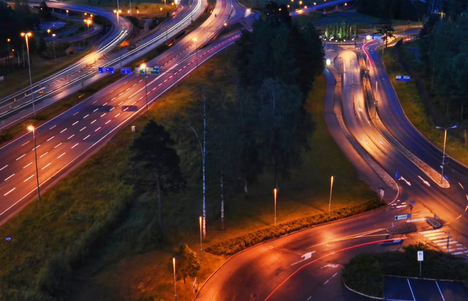
The intersection of transport systems and geospatial information is becoming more crucial than ever. Geospatial technologies are no longer confined to merely mapping and navigation; they are reshaping transport and urban planning, offering robust tools for data collection, analysis, and visualization.
In an era where the challenges of climate change, urbanization, and social inequality are increasingly pressing, the integration of geospatial technologies with sustainable transportation is proving transformative. As the world grapples with its transport infrastructure, there's a significant role for geospatial intelligence, providing new, innovative ways to perceive and experience mobility.
The intersection of transport systems and geospatial information is becoming more crucial than ever. Geospatial technologies are no longer confined to merely mapping and navigation; they are reshaping transport and urban planning, offering robust tools for data collection, analysis, and visualization. Especially when combining static and dynamic geospatial information, the traffic patterns and phenomena – for instance – can be identified and assessed and hence to be used in optimizing operations, improving efficiencies and fostering sustainability and traffic safety. Ultimately insights of geospatial information can be used for building urban mobility strategies.
Moreover, predictive modelling offers vital insights into how regional development patterns and transport infrastructures influence population dynamics. By broadening scope from urban areas to include these underserved rural or developing areas, a more holistic understanding of global transport networks could evolve, fostering a more equitable approach to transport development.

Innovative technologies such as connected and autonomous vehicles (CAVs) promise to revolutionize transportation by enhancing efficiency and sustainability while reducing carbon emissions and traffic congestion. Within this context geospatial analysis is effectively used to enhance road safety by identifying high-risk areas. CAVs represent not just a technological shift but also a broader societal change in our experience of mobility—transforming travellers into passengers and observers.
Further, as CAVs and other location-aware technologies become more prevalent, transport systems are becoming more connected and smarter. The integration of real-time geospatial data supports the development of multimodal transport networks. This network integration allows travellers seamless transitions between various modes of transportation, such as ride-sharing, micromobility and shared vehicles, thereby fostering sustainable urban mobility. For sure, walking and cycling should not be forgotten either.
Looking ahead, sustainable transport systems present opportunities and challenges that demand a concerted, interdisciplinary effort. Collaborative partnerships among technologists, urban planners, policymakers, and environmental and social scientists are essential to drive sustainable solutions. Emphasizing holistic perspective going beyond urban environments and encouraging public participation could further support behavioural shifts towards lower-emission transport modes.
In addition, embracing an emerging geospatial consciousness can transform how we manage and experience journeys. Location intelligence, augmented by virtual reality and AI, empowers travelers to interact with their surroundings in meaningful ways. Such technologies can enrich journeys, transforming what was once a gap between departure and arrival into an engaging narrative rich with discovery and learning.
Moreover, changing the modal split in traffic can significantly aid urban environmental restoration. By shifting from reliance on cars to more sustainable modes like cycling, walking, and public transit, cities can improve air quality and accessibility, reduce noise pollution, and free up space for green areas. These changes enhance urban life by making cities more liveable, community-focused, and environmentally friendly. Additionally, they contribute to reduced carbon footprints and support climate goals, fostering a healthier, more sustainable urban environment.
Geospatial information plays a crucial role in urban planning, environmental management, transportation, and more.
It helps city planners optimize resource allocation, supports emergency services in crisis response, enables precise agricultural practices, and aids businesses in strategizing market efforts. By providing spatial context to data, geospatial information allows for informed decision-making, helping industries and governments address complex challenges with greater efficiency and precision.
The journey toward sustainable mobility, bolstered by geospatial technologies, offers not just a path to better machines or networks but an opportunity to reimagine how transport fits harmoniously within our lived environments. By integrating technology with sustainable practices, we can redefine urban landscapes, making them more vibrant and suitable for future needs. In this transformative era, embracing these advancements is vital to building transport systems that are inclusive, efficient, and sustainable for all.
To advance sustainable transportation, integrating geospatial technologies is vital since it enables facilitating informed decision-making across various sectors, including urban planning, environmental management, and crisis response, by providing critical spatial context and improving operational efficiency.
Recommendations include broadening transport development to encompass rural and surrounding regions and foster interdisciplinary collaboration among technologists, urban planners, policymakers, and environmental scientists to drive innovative solutions.
Engaging public participation is crucial to increase awareness, achieving acceptability and equality, and encourage behavioural changes toward lower-emission transport modes. Additionally, advancing technological integration by refining technologies that support multimodal transport networks and real-time data adaptation will enhance transport systems to effectively meet future demands.

1. Urban planners and environmental management
Resource pptimization: Geospatial information aids in more efficient urban planning and resource allocation.
Environmental protection: Transitioning to more sustainable modes of transport, such as cycling and public transit, can improve air quality and reduce noise pollution.
2. Transport and technology developers
Connected operations and vehicles: Geospatial information enhances operations and predictability and hence promotes sustainability.
Multimodal transport: Real-time geospatial data supports the integration of different modes of transportation, facilitating seamless transitions for passengers between various transport modes.
3. Policymakers and politicians
Infrastructure development: Geospatial data helps understand how transportation infrastructure affects population dynamics and urbanization.
Rural development: Expanding the use of geospatial data to rural areas can create more equitable transportation networks.
4. Communities and the general public
Public engagement and behavioral change: Geospatial information can increase awareness and encourage the adoption of sustainable transport modes.
Urban livability: Technology transforms travel experiences, making cities more vibrant and community-oriented.
5. Businesses and marketing strategists
Targeted marketing strategies: Geospatial data allows businesses to analyze markets and optimize strategies, leveraging spatial context for informed decision-making.
