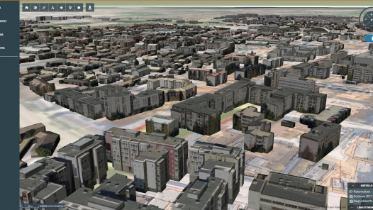
The Louhi geospatial platform is a comprehensive geospatial management solution. Louhi is suitable for companies and organisations of all sizes, as well as municipalities and cities.
Louhi's public map service and interfaces also allow you to share map data with different stakeholders. The uses of Louhi are almost limitless for better spatial management.
We dare to say that everyone needs spatial information to support their decision-making!
The Louhi GIS platform brings together up-to-date data sets from different sources and makes the information understandable, so you can make sustainable decisions for the long term, not just for tomorrow.
Louhi supports decision-making with clear visual snapshots and spatial analyses. Louhi offers a wide range of solutions for knowledge management, information management and information discovery.
Geospatial solutions for your needs!
The browser-based Louhi consists of modules that can be assembled to meet the needs of customers in the best way. Louhi's responsive interface works both on the desktop and in the field on mobile and tablet devices.
Louhi is a daily tool to manage official processes – infrastructure asset management, land use planning, landed property management, management of permit processes, and presentation and maintenance of geospatial data sets.
Louhi Palaute is a map-based feedback service that functions as a digital feedback system.
Louhi Hanke is a GIS-based data management solution for infrastructure and regional development projects.
Louhi Seppä enables the collection, storage, and maintenance of geospatial data points directly with the web interface, even in field conditions. As a generic solution, the data collection form can always be designed with the customer’s specific needs in mind.


